1734 Murillo-Velarde Map Highlights Rich Philippine Materials at Leiden University Libraries
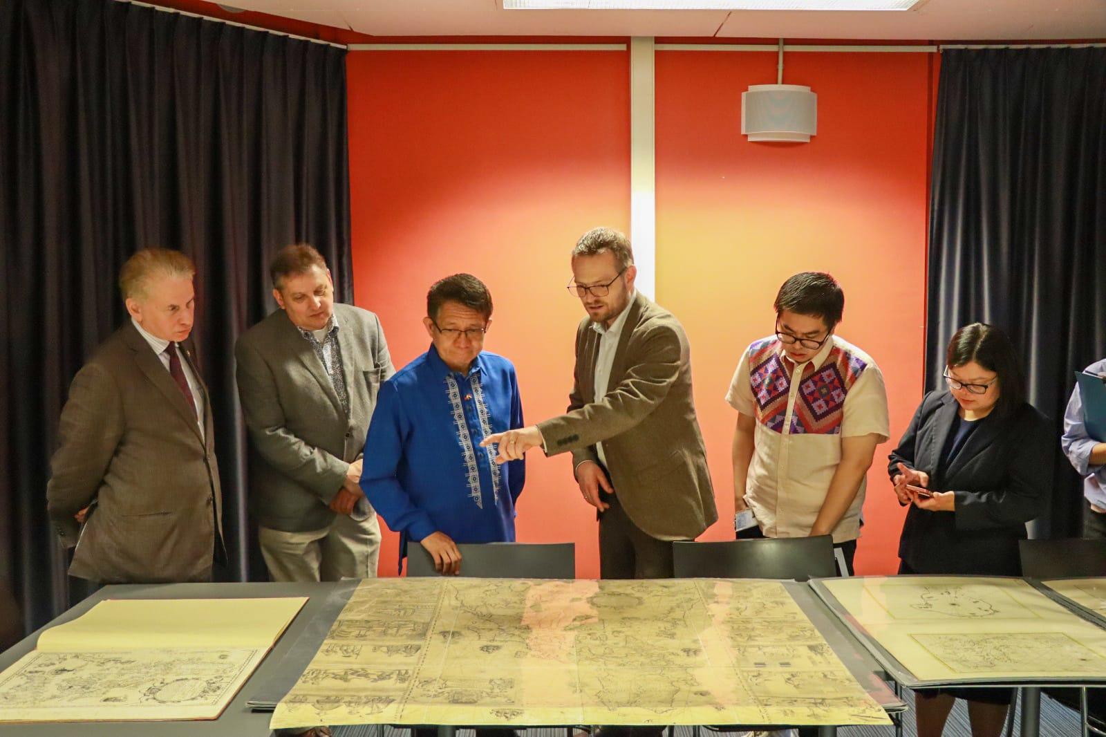
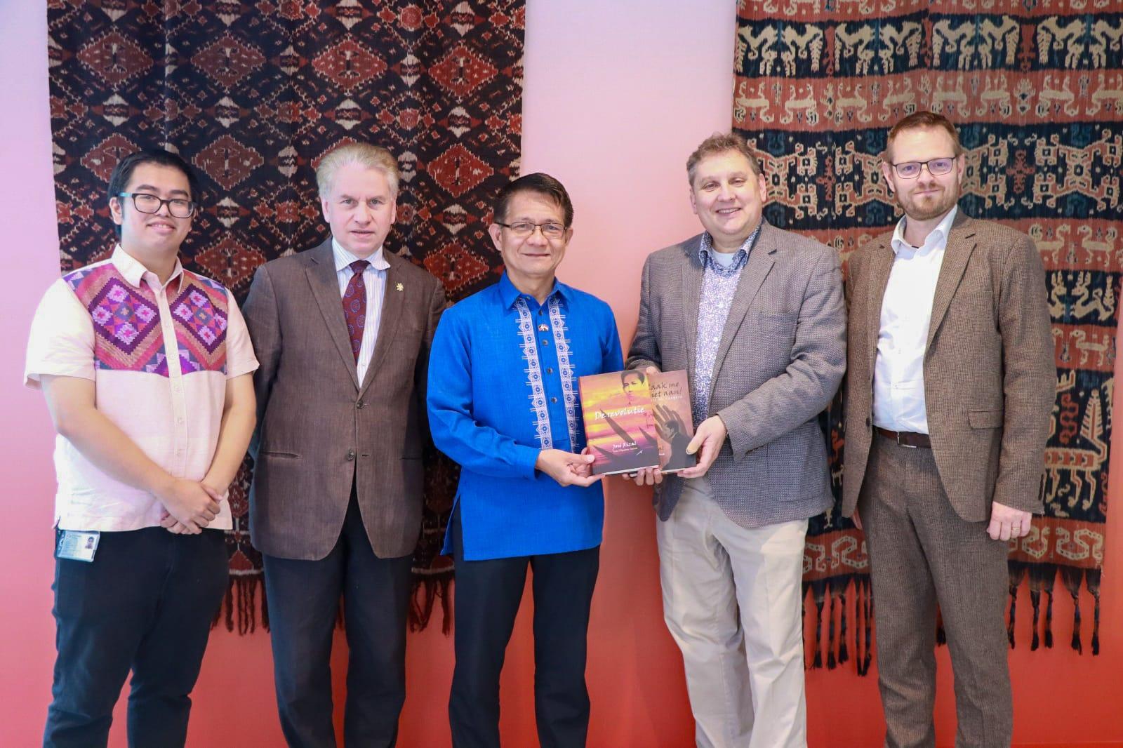
(From left to right) Mr. Anton Lutter, Deputy Director Marco de Niet, Ambassador J. Eduardo Malaya, Curator of Maps and Atlases Martijn Storms, Mr. E. Joaquin Lopez and First Secretary and Consul Irish Kay Kalaw-Ado
THE HAGUE 07 July 2025 — The rich and substantial Filipiniana materials available at the Leiden University Libraries’ Special Collections were presented to Ambassador J. Eduardo Malaya and the Philippine Embassy team on 27 June 2025, underscoring the deep historical connections between the Philippines and The Netherlands through old books, photographs and maps, notably the renowned 1734 Murillo Velarde Map. The presentation was made in response to the Embassy’s thrust to further discover and promote historical materials on or about the Philippines that are present in Dutch libraries, museums and archives.
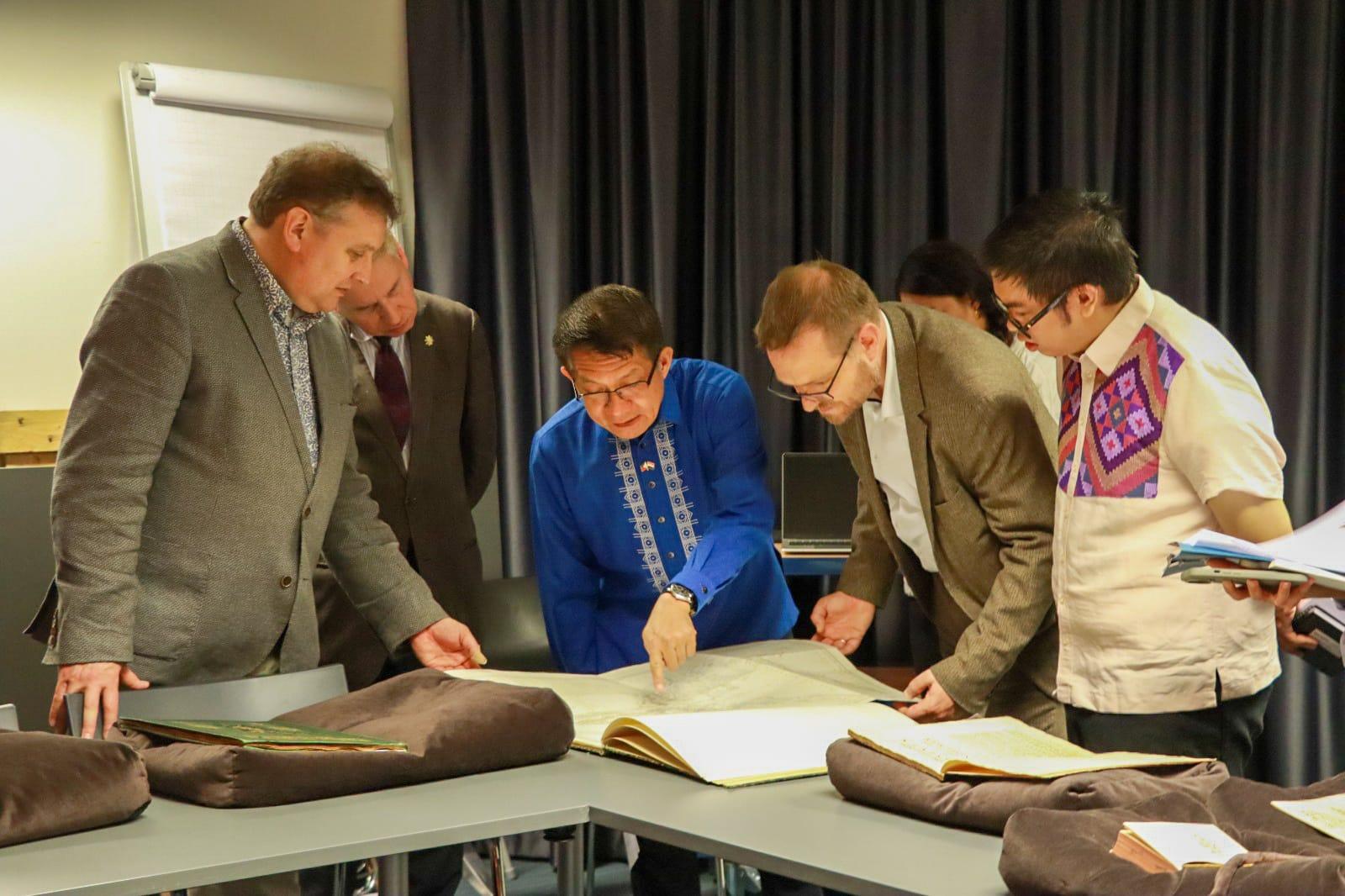
Among those shown was an original Murillo Velarde map “Carta Hydographica y Chorographica delas Yslas Filipinas,” along with other significant historical items. There are fewer than 20 original copies of the map that exist today.
The presentation was made by Curator of Maps and Atlases Martijn Storms, who was accompanied by Library Deputy Director Marco de Niet. Also present were Mr. E. Joaquin Lopez of the Leiden University’s International Institute for Asian Studies and Mr. Anton Lutter of the Knights of Rizal.
“We are glad that these important Filipiniana materials have been cared for by Leiden University. These are valuable snapshots of our past, and the more we understand the past, the better we can plan for the future,” Ambassador Malaya said.
The 1734 Murillo Velarde map is known as the “first and most important scientific map of the Philippines” and the “mother of all Philippine maps” as it provided the basis of subsequent maps in the 18th century. While it is known as the Murillo Velarde map after the Spanish Jesuit priest and cartographer Pedro Murillo Velarde (1696-1753), it is in fact a Hispano-Filipino collaborative work between Murillo Velarde, the well-known Tagalog engraver Nicolas de la Cruz Bagay (1701-1771) and Tagalog Francisco Suarez, who drew many of the marginal scenes. The original copy was part of the collection of 19th century Dutch lawyer and map collector Johannes Tiberius Bodel Nijenhuis, who later donated the Murillo Velarde and other maps to Leiden University.
In addition to the Murillo Velarde map, Curator Storm presented seven other 18th century historical maps providing the Dutch and European insights on the early Philippines and Southeast Asia, including the oldest Southeast Asian map made by Dutch cartographers Arnoldus & Franciscus van Langren, dated 1595 and published in Jan Huygen van Linschoten’s Itinerarium.
The University Library also showed four books on the Spanish colonization of the country, notably the 1732 Dutch publication “Historiche Versaamelingen over de vaart der Spanjaarden na de Philippines” by Mauricius. Additionally, the 1846 atlas book by French Jean Mallat, titled “Les Philippines”, features world maps and sketches and photographs of Filipinos representing different regions. The other two books presented were historical travel accounts in French and Italian, with a specific volume on the Philippines, and in German languages, respectively.
Other highlights of the Leiden Special Collections are three barely studied and unpublished historical photo albums, a collection of photographs by P.K.A. Meerkamp van Embden, a businessman from a tobacco trading family in Rotterdam and later appointed and served as Honorary Consul in Manila from 1889 to 1927. It includes some photographs of the “Pact of Biak na Bato,” San Miguel Street where the Malacañang Palace is located, and various family portraits, among others.
The Embassy officials are in talks with University Library officials on future collaborations on the Filipiniana materials.
Ambassador Malaya took the occasion to donate to the Leiden University Libraries the Dutch translations by Mr. Gerard Arp of Jose Rizal’s novels “Noli Me Tangere” (Raak Me Niet Aan) and “El Filibusterismo” (De Revolutie: Een Filipijnse Roman), and the Embassy’s publications “Crossroads: A Compendium of Agreements between the Philippines and The Netherlands, 1951 to 2025” and the “Philippine Chancery in the Netherlands: Renewals and New Beginnings in a Heritage House,” among others.
Established in 1575, the Leiden University Libraries is an internationally recognized research library of the Leiden University, the oldest university in the Netherlands that is celebrating its 450 years this year 2025. It is a library, museum and archives rolled into one. The maps and other digital collections of the library, including those with connections with the Philippines, are publicly available at https://digitalcollections.universiteitleiden.nl/. END
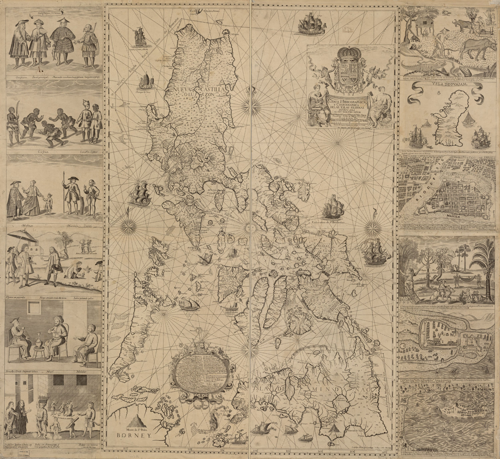
Map: Carta Hydrographica y Chorographica de las Yslas Filipinas (Hydrographic and chorographic map of the Philippine Islands) – the map referred to as the “first and most important scientific map of the Philippines” and the “mother of all Philippine maps” by Pedro Murillo Velarde, 1734 (Photo courtesy: Leiden University Library Digital Collections)
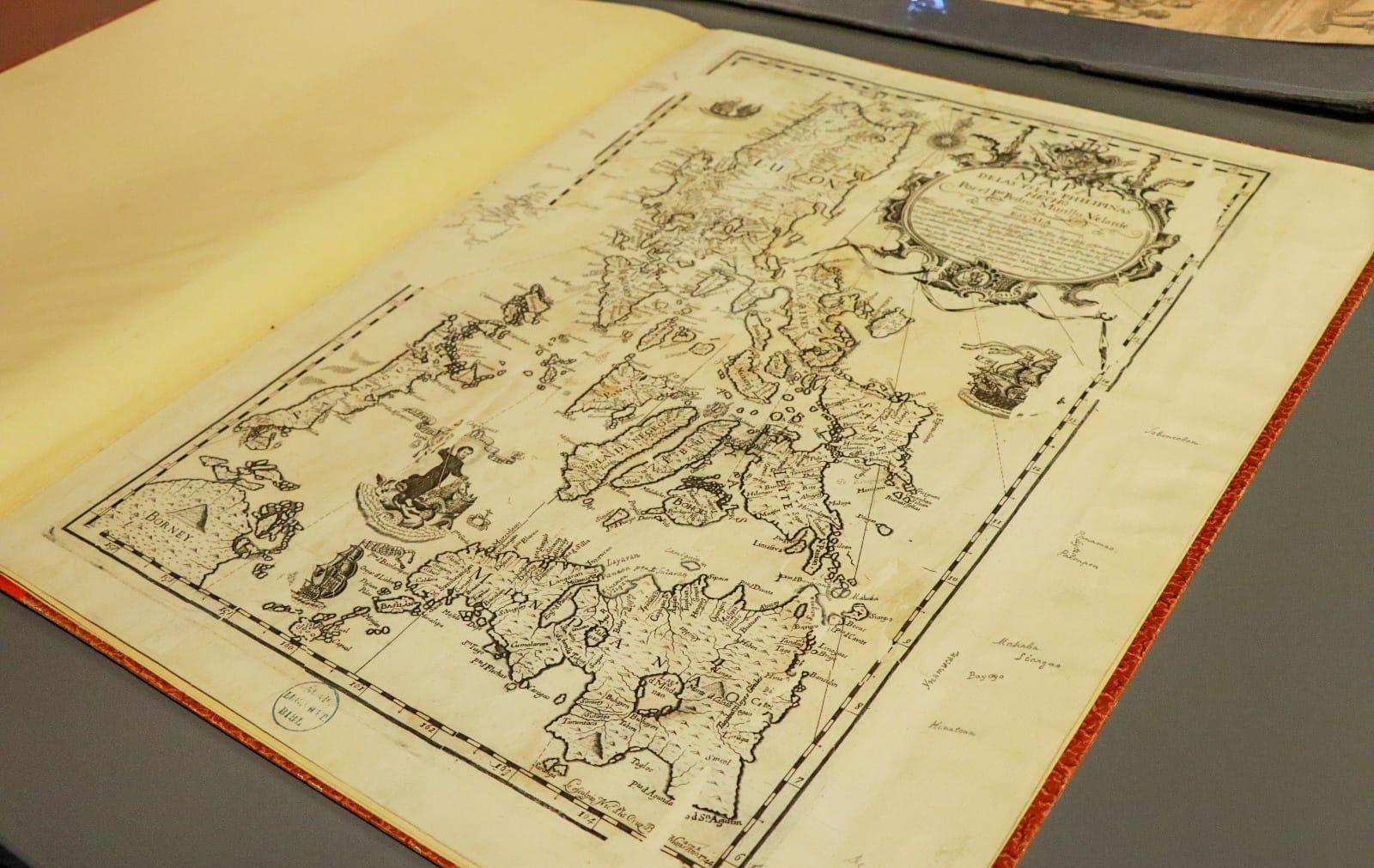
Mapa de las Yslas Philipinas (Map of the Philippine Islands )– Pedro Murillo Velarde, 1744
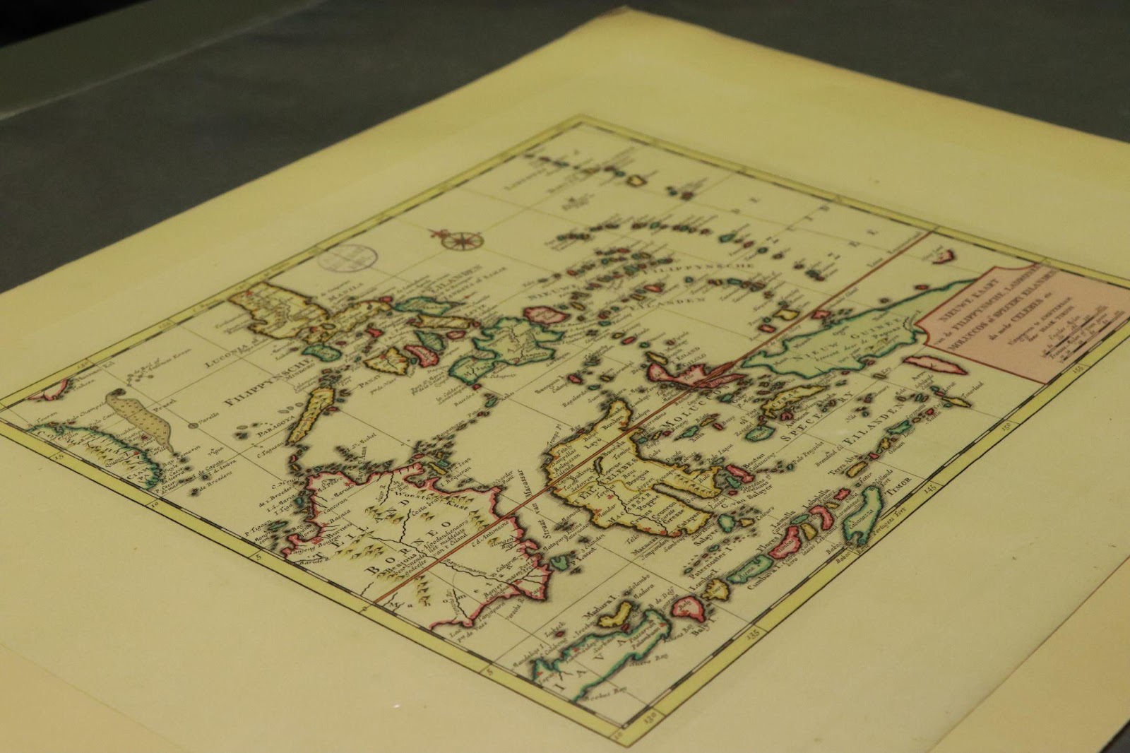
Map: Nieuwe kaart van de Filippynsche, Ladrones, Moluccos of Specery Eilanden alsmede Celebes (New map of the Philippine, Ladrones, Moluccas or Spice Islands, as well as Celebes) – Isaak Tirion, 1740
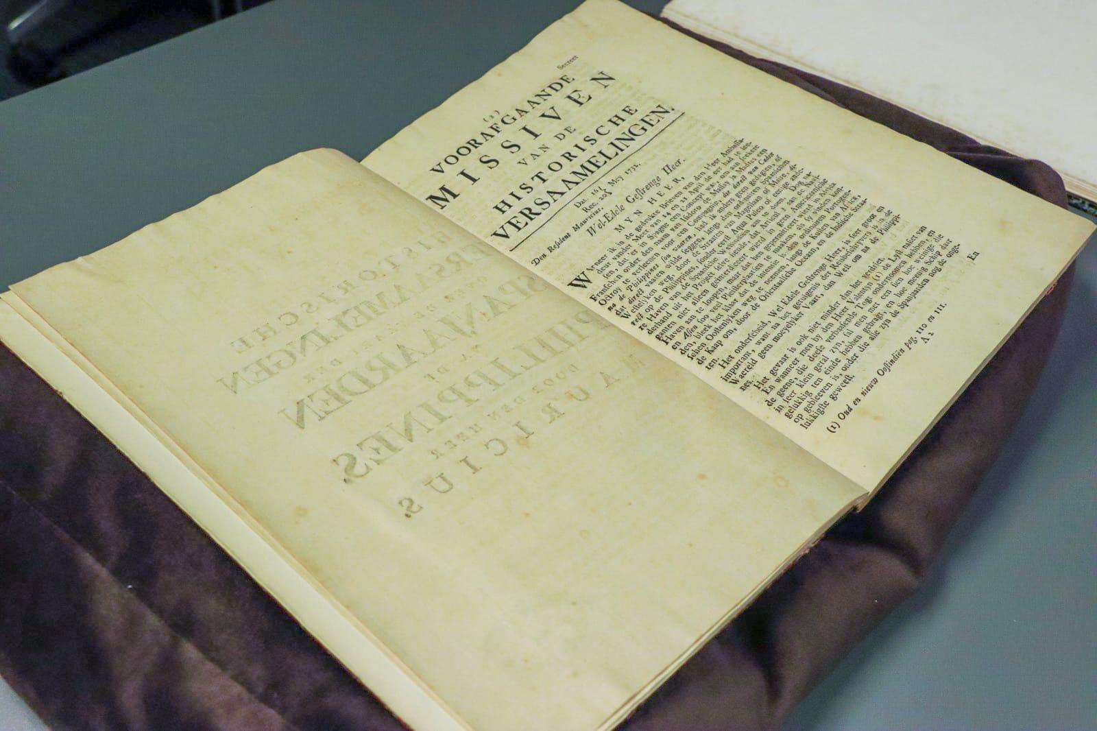
Book: 1732 Dutch publication "Historiche Versaamelingen over de vaart der Spanjaarden na de Philippines"
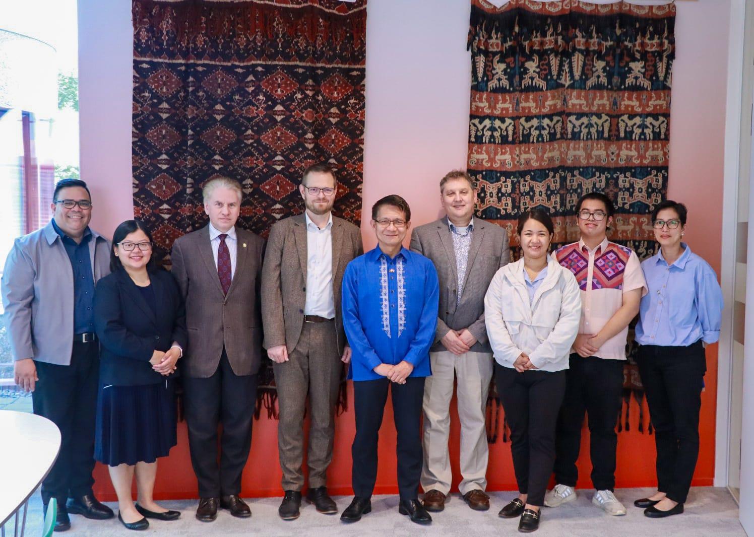
(From left to right) First Secretary and Consul Nomer B. Ado II, First Secretary and Consul K. Ado, Mr. Lutter, Deputy Director Marco de Niet, Ambassador Malaya, Mr. Storms, Third Secretary and Vice Consul Crystal Gale Dampil, Mr. E. Joaquin, and Cultural Officer Joan Pichay
Leiden University Library
For more information, visit https://www.thehaguepe.dfa.gov.ph, https://twitter.com/PHinTheHague or https://www.facebook.com/PHinTheNetherlands/.